Mon - Fri: 8 am - 4 pm MT

About Backcountry Journeys
Why Choose Backcountry Journeys
If you're considering a photography trip, hear why Backcountry Journeys delivers the best experience in the industry.Frequently Asked Questions
If you're new to photography trips, or new to BCJ, you can find our common travel questions here.Fitness Levels
Our trips vary on physical intensity, and by reviewing our fitness levels, you can find out which trips may be more challenging, or aligned more closely with your comfort level.Meet The Crew
We've built an amazing team of experienced guides, and dedicated office staff that elevate your travel experience. Get to know their backgrounds, and hear their stories.Loyalty Program
We reward our frequent photo adventurers with exclusive discounts on amazing photography trips.Contact Us
If you need to get in touch with our office staff, or have additional business inquiries, you can find our information here.Refer a Friend
Know someone perfect for one of our tours? Recommend them through this quick form.Stay Up To Date On All Things
Backcountry Journeys
Backcountry Journeys
Our Photography Community
Our Webinars
Our regularly hosted webinars provide photography instruction from our own guides on a wide range of topics.Our Education Portal
Explore our library of articles that cover everything from common questions, to in-depth guides on how to achieve that perfect shot.Community Testimonials
We're proud to foster an amazing group of photo travelers, and here you can find their stories from their past adventures.Resources For Photographers
About Our Company
Resources For Photographers
About Our Company
Trip Report: Southwest Monsoon: Grand Canyon Country – July 2019
Published September 2, 2019
Billed as “Southwest Monsoon,” this landscape photography oriented expedition was designed to put our group in front of the most iconic and spectacular locations that Grand Canyon country has to offer, during the stormy season, a time when it is these spots are at their most electric and photogenic best. Lightning, thunder and sheets of rain as a backdrop on locations like Monument Valley, Horseshoe Bend, Grand Canyon, among others. Perfect trip!
Monsoon in this part of the world begins officially in mid-June, however, daily rains typically begin in very early July.
Each year. Always. Nearly always. Not exactly this year, however.
I suppose we ought to look at a trip designed around chasing specific weather phenomena in much the same way as we would approach a trip designed to search for wildlife. As reliable as the summer Monsoon normally is here, it proved this year that it too is capable of being just as fickle as wildlife. It is weather after all.
Leading up to our late July seven day adventure, the forecast did not look “good” for a group of photographers looking to photograph lightning storms. In fact, the Monsoon which was supposed to begin weeks earlier had yet to really arrive with its classic daily sheets of rain, thunder and magnificent lightning.
What we were “left with” was a first-hand look at some of our country’s most iconic scenes and locations. We made plenty of images of these fantastic places. We also made memories and friendships, and in the end, went back to our homes with a real sense that we’re all just dang fortunate human beings. Perspective. Something Grand Canyon (country) is really good at providing folks willing to sit with it for a while and listen.
In the end, we were blessed with a few storms and a little bit of lighting. However, the locations visited, sights seen, and memories shared would prove to far outshine our lack of storms.
Day One
Our day one began in Flagstaff, Arizona. Which is Backcountry Journeys ‘World-Headquarters.’ We met for our traditional dinner and orientation meeting. Seven folks from across the country came together for this experience. Texas, New Jersey, Arizona, Tennessee, and Cincinnati were all represented. Six of our seven guests were prior BCJ guests, three of whom knew each other from a previous 2019 tour.
Instead of dinner at the hotel, we decided to show off our little town and went to a local ‘hot spots,’ Beaver Street Brewery. Beaver Street sits on the south side of the rail line that splits downtown ‘Flag’ into north and south. Over 100 freight trains pass through town on this track on a daily basis, and we heard what seemed like nearly half of that number during dinner, while dining in the cute outdoor patio nestled in the back of the building, just beyond a fence from the rails. In between trains we were able to discuss our fast-moving itinerary and the weather, as those two issues were the talk of the evening.
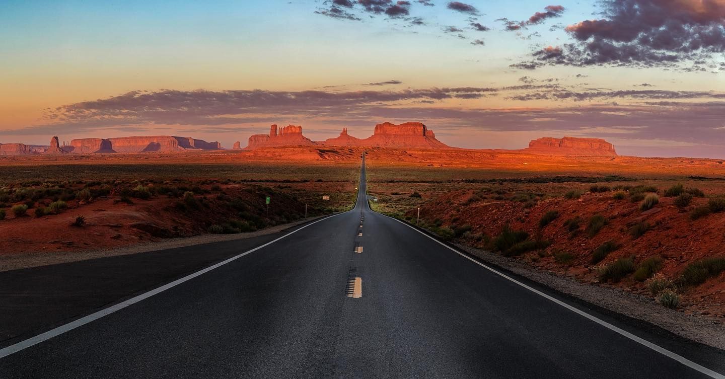
We were not going to be deterred by our weather outlook. Our itinerary looked like someone had taken the best “Bucket List” ever made and checked off half of it. Monument Valley. Horseshoe Bend. Lake Powell. Antelope Canyon. The GRAND CANYON! For anyone familiar with the works of author Edward Abbey, these locations he so marvelously described as central to the very beating of his heart all ring true. They are the best of the best in the southwestern United States if not all of the country. These places have come to define the American Southwest and we had all of these iconic locations ahead of us, with or without the lightning and rainstorms most visitors wouldn’t want to begin with.
After dinner, we went back to our hotel in preparation for our next week on the road together. It was going to be exciting, no doubt.
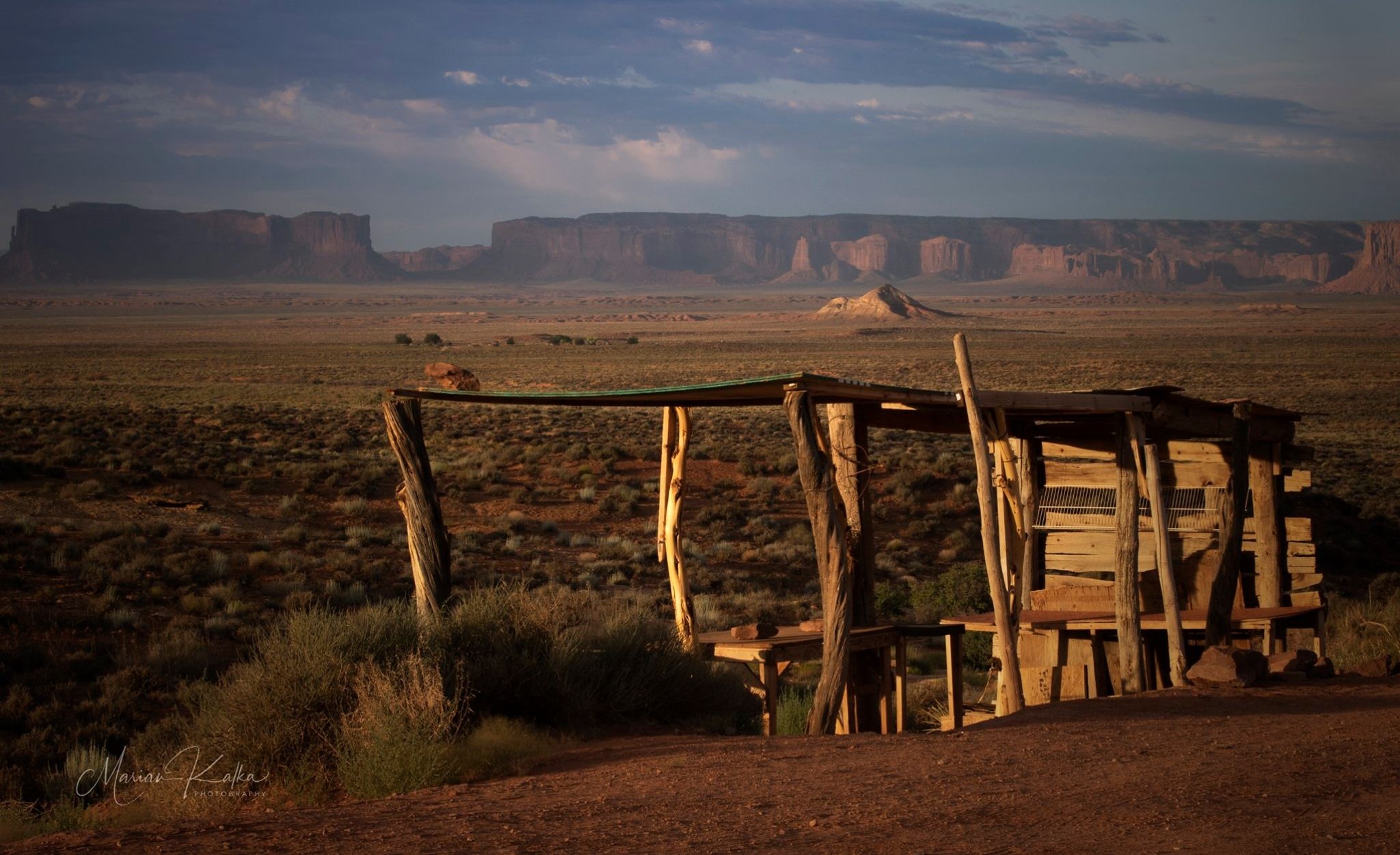
Monument Valley
So, our little group of seven (plus me, if I count?) set out for a summer road trip that would take this cast of “Car II Characters” (inside joke warning-sorry) across America’s Southwest with lightning on our minds and cameras by our sides.
Our first morning together began with a long, yet scenic, drive north from Flagstaff through Navajo Nation towards Monument Valley. Navajo Nation is huge and expansive as you’d think that you can actually see across its 17.5+ million acres. It reaches from just north of Flagstaff, AZ all the way to Utah, across to Colorado and into a bit of New Mexico. At roughly the size of West Virginia, it is the largest reservation in the United States with a population of over 350,000 people.
Monument Valley belongs to the Navajo people and sits in the upper northwest portion of their land. This place has been seen in film and in magazines and in photographs since the 1920s when it was taken to Hollywood by Harry Goulding, a resident of the Valley, and owner of a failing trading post there. In the 1930’s Goulding thought he could save his business by bringing fame to Monument Valley. He was right! Filmmaker John Ford loved the photographs he was shown of the place so he filmed his next movie, Stagecoach, there complete with the sandstone towers, buttes, and mesas as a backdrop. All-in-all, five John Wayne films were made here, and the rest is history. Harry Goulding’s little trading post remains to this day.
This film history, however, is not the only history that should be referenced when discussing Monument Valley. It is in its cultural history that Monument Valley should be revered through. The Diné (Navajo) have lived here for generations, making their home among the sand, wind and dry heat here. Some still remain amongst the towers and buttes that carry their family name.
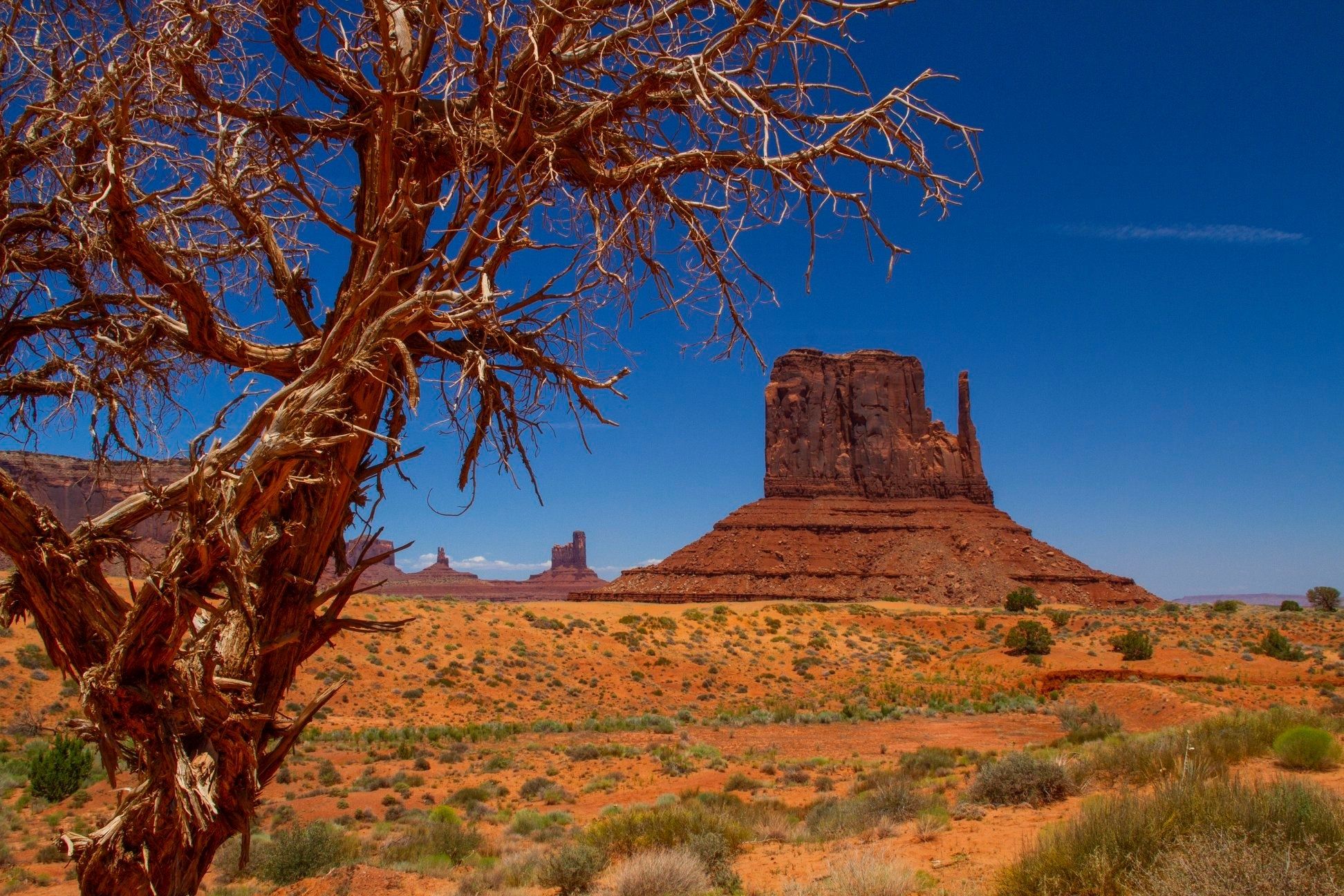
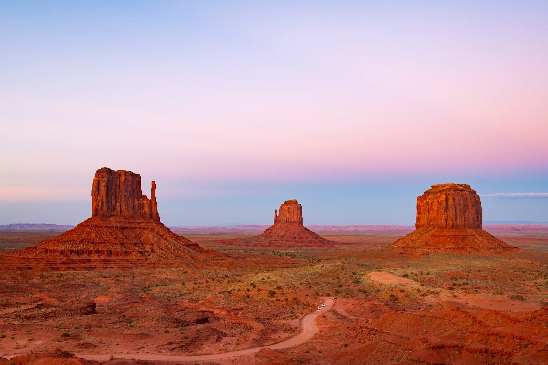
We arrived on a hot (100+F), completely clear blue sky day. The monuments were on fire, glowing in the bright sun. While this is clearly not ideal conditions for landscape photography, we took to the loop road that navigates and winds through the Tribal Park. We saw, and photographed, all of the famous spots: The ‘Mittens’ and ‘Merrick Butte,’ ‘John Ford Point,’ ‘Three Sisters,’ ‘Artist’s Point’ and the ‘North Window.’ It is really remarkable to think about how forces as ‘everyday’ as wind and water could have eroded this landscape into what we have here now. Of course, it took over 50 million years to do so, but still.
Donn Brookes
After checking into our hotel and grabbing dinner at our really nice hotel in nearby Kayenta, we returned to the Tribal Park to catch a magnificent sunset from the most classic viewpoint in the park. After a day of begging and pleading with whichever god is responsible for placing wispy and colorful clouds in our intended scene, the sunset on our first day at Monument Valley with only a few clouds, a bit offset from perfect. Our sunset images came out nicely, however, and I think most were pleased with their efforts.
Bill Harvey
Not yet done with Monument Valley, the following morning we set out in the dark of morning for the spot made famous by yet another film.
Do you recall that moment when Forrest Gump finally got tired after running back-and-forth across the country? Well, that moment when it was time to “go back home to Jenny” was right here near Monument Valley.
Kenton Krueger
This spot, known as “Gump Hill” (there is even a sign to memorialize the spot), has become HUGE in the photography world, as well as in the world of Instagram. Many in our group would be introduced on this tour to “Instagrammers,” the first experience coming right here at Gump Point.
Marian Kalka
As the sun softly rose on the monuments along our horizon, we were happily shooting away from the middle of the highway (safely, I may add), a young couple pulled up and got out of their car to take some cell phone photos of their own.
Nothing odd here, right? Well, as they set their backpack down and began shooting we heard a clearly audible “meow” coming from somewhere. Now, mountain lions do reside in locations around the southwest, as do bobcats, but this could not be that.
“Meow!!”
It was seemingly coming from the backpack sitting on the roadside! What business does a housecat have being out here in the middle of nowhere, in a backpack sitting on a roadside? Apparently, he was cast as a secondary role in an Instagram shoot that the young couple had planned. This “shoot” would become our entertainment for the next half-hour, or so, as we watched with amazement as the young woman would carefully shoot the young man skateboarding down the road. Shots of him dressed as Forrest running up the hill. Shots of the cat on a leash. Certainly interesting phenomena for those of us unfamiliar with the curious nature of the world of Instagram.
Following our morning shoot, we packed up and moved on down Highway 98 towards the town of Page, Arizona, where we’d stay for the next two nights. This would not be our last “Insta” encounter, but it was the most memorable.
Page (Horseshoe Bend/Lake Powell/Antelope Canyon)
The town of Page sits at the border of Arizona and Utah and is home to not only the Glen Canyon Dam and Lake Powell, but also to Horseshoe Bend and Antelope Canyon. We’d be visiting/shooting all of these locations. Page was initially settled during the construction of the Glen Canyon Dam, which when completed in 1963 flooded Glen Canyon, creating Lake Powell. The lake is the second-largest man-made lake in the country, behind Lake Mead, and is marked by stunning shoreline coves and sandstone towers and buttes that jet out from the lake.
Upon our arrival, skies were as blue as blue can be, and temperatures were in the triple digits, so we took the opportunity to check out the Glen Canyon Dam interpretive center. The Carl Hayden Visitor Center sits right next to the bridge and dam, perched precariously high up on a cliff looking down on the Colorado River over 700 ft below. After walking the bridge, getting photographs of the dam and river, we went into town for a Texas-sized lunch at Big John’s Texas BBQ. It was delicious, even living up to the lofty standards of our three Texans; Laurie, Marian, and Bill.
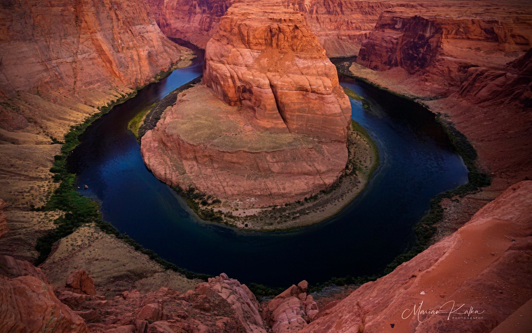
After checking into our hotel and taking a quick break, we set out to Horseshoe Bend for our sunset shoot. Sunset time at Horseshoe Bend has become quite the circus. Instagrammers, photographers, and sightseers alike from every single corner of the globe are here to witness the event. We left from our evening here with decent shots, but far from what we really wanted, as the light was not great and a nasty windstorm kicked up sand from the rock into our faces pretty steadily all evening. The crowds of Instagrammers, photographing themselves in some of the more ridiculously inappropriate (for the area) clothing were a bit overwhelming. It was difficult at times to maintain our position with our tripods as visitors pushed through like in line for a subway in New York. We were not to be deterred, however. We did as best we could, and retired for the evening after a late dinner. No real worries here as we planned to revisit Horseshoe Bend for a sunrise shoot, so we’d have ourselves another crack at it.
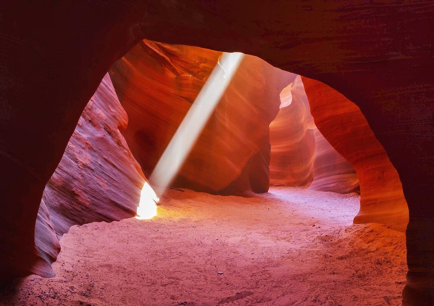
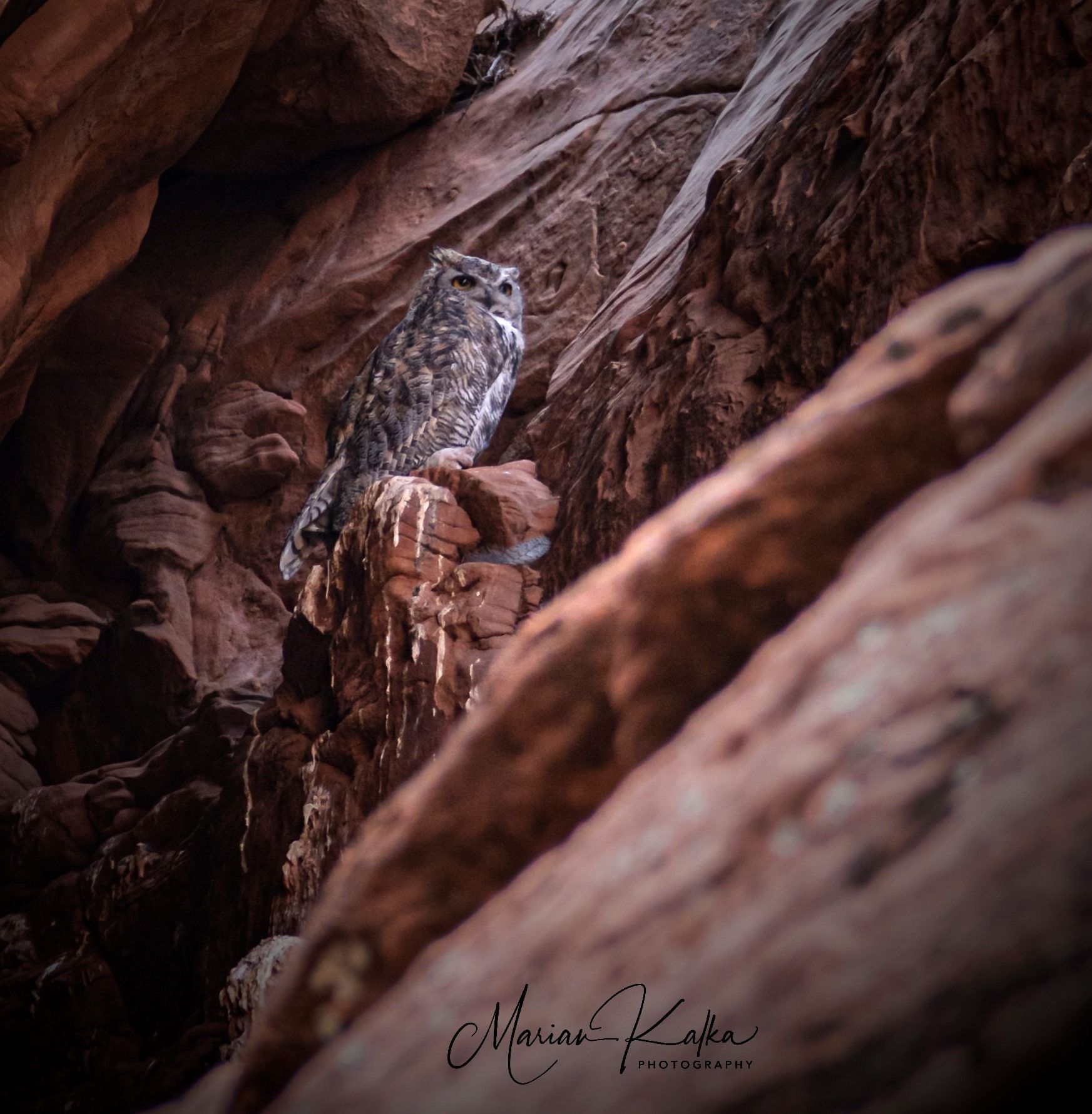
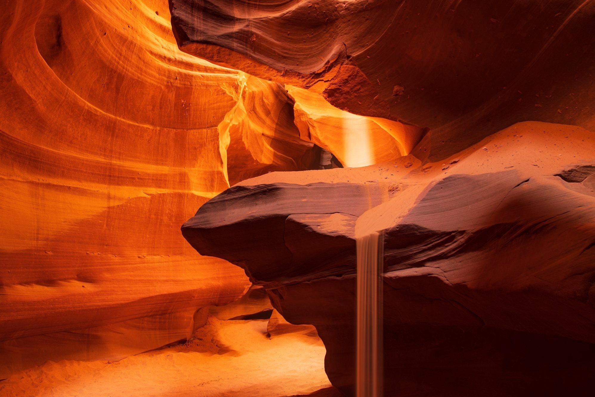
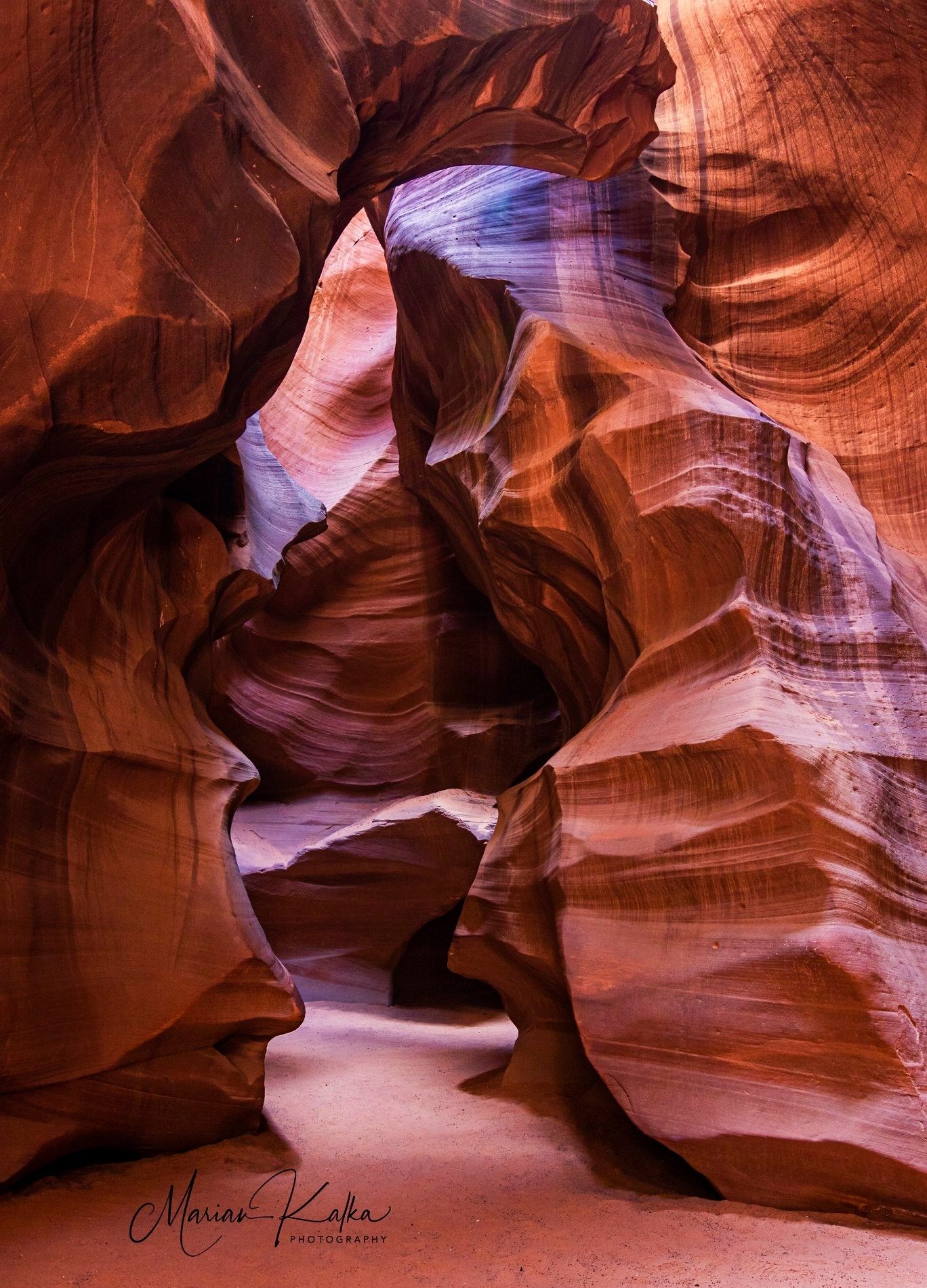
The following morning our adventure would take us to the truly special Antelope Canyon, as well as an exploration of two other nearby canyons, ‘Owl’ and ‘Rattlesnake.’ We spent all morning shooting inside these canyons. Our first two canyons were ‘Owl’ and ‘Rattlesnake,’ and we had these completely to ourselves.
Kenton Krueger
Excellent images were made inside these much lesser-known canyons in preparation for the day’s main event. And you guessed right, “Owl Canyon” is named as such because there is an owl living inside of it.
Marian Kalka
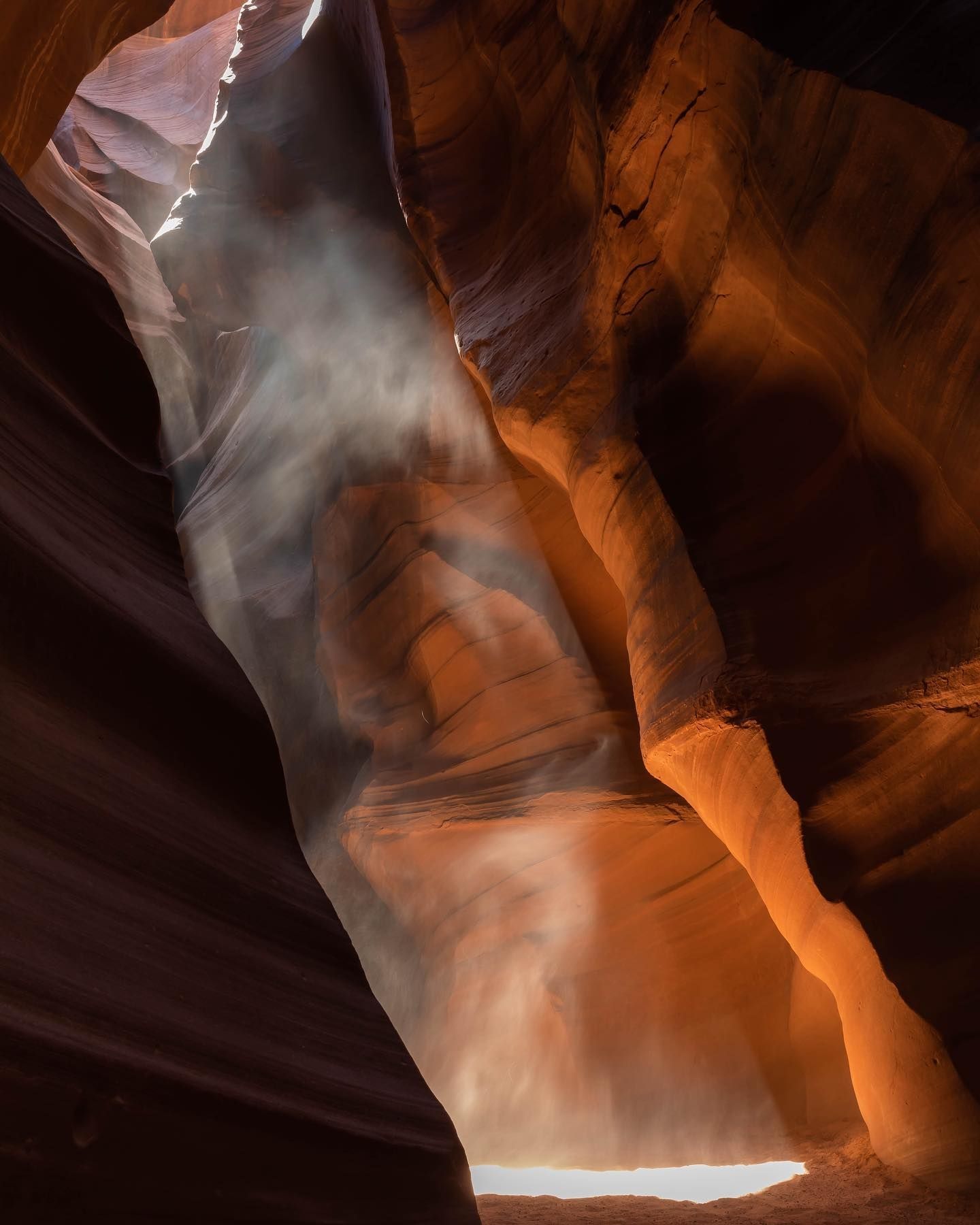
Antelope Canyon is one of the most photographed places on the planet. I can safely bet that every single person reading this has seen an image of Antelope Canyon.
Kenton Krueger
It has become a destination for people from across the world and is set up by the Navajo who run the place in order to move visitors (including us) through the Canyon with frightening efficiency. The photographer specific tour is the way to go for anyone with a DSLR or Mirrorless and tripod (anyone on a photo-specific tour must have these things as a minimum. They check, to make sure!). Our Navajo guides made sure that we not only got to all the spots at the exact right time for light beams, but they also moved other spectators out of the way and gave us plenty of time to craft our compositions and make our images. The results (seen here) are outstanding images full of color, composition and of a story told of what seems like a completely vacated dark desert canyon.
Bill Harvey
The fact of the matter is that there are hundreds of people just out of sight, but this place lives up to its billing! Being inside Antelope Canyon is not really an out-of-doors natural world experience. Think of it more like going to the Louvre, in Paris.
Marian Kalka
It is a beautiful museum that you are sharing with a lot of other folks. Having our Navajo guides was crucial to the outcome of our images, and we had good guys from Adventurous Antelope Canyon helping us along the way!
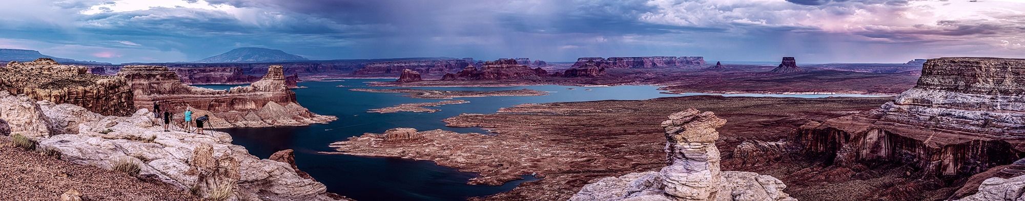
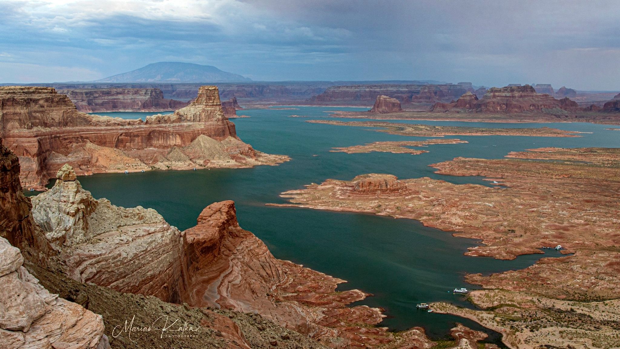
Following our morning at Antelope Canyon, we grabbed lunch at Antelope Point Marina restaurant, which is right on the lake. Our afternoon break would be minimal today as we had a long road adventure ahead. Alstrom Point, our sunset location for the evening, is a long journey. Not as much in mileage, as it is only roughly 25 miles of graded dirt road around Lake Powell to a viewpoint unlike any other on the lake. But, a slow journey across the rough and dusty road. Well worth the time and energy, but for this one, our rental 15 passenger chariot (van) would need an assist.
Russ To the Rescue
While planning the trip, Russ and I knew that to successfully get all the way to the best part of Alstrom Point we would need help in the way of a big ‘ol 4×4 truck. The road to the Point is passable (as long as it’s not raining too much) in a normal vehicle up to about 2 miles shy of where you really want to be for the best composition of the lake. The rest of the way required the ability to climb a few large sandstone “staircases” and maneuver through some pretty rough spots. The solution was that Russ, the founder, and owner of Backcountry Journeys, would join us in time for our Alstom shoot so that his big truck could be used to ferry folks the last two miles to the shot. Let’s go that extra mile (well, two in this case), shall we?
And was it ever worth it!!
Woods Blake
Monsoon conditions were to reappear in the area beginning that afternoon, and by that evening as we approached Alstrom Point, there they were, off in the distance! Clouds. Dark clouds. Golden light beams passing through the clouded sky, and even a rainbow all presented themselves!
Marian Kalka
Holy cow, and look where we were! Perched hundreds of feet above the lake on a straight cliff!! We had a picnic dinner on the point, and as the light grew softer, and the night settled in, we could not have thought of a better place to be at that moment in time. It was one of those evenings, in one of those spots, that gives a person goosebumps. It certainly did here for us that night.
We arrived back at our hotel late that night and needed to rush to bed. Our wakeup call for the next morning’s return to Horseshoe Bend was only a few hours away and we were pretty tired from a really incredible day of canyons and cliffs, lakes and light shows. This was one amazing day, indeed!
Marian Kalka
Horseshoe Bend in the morning proved to be the antithesis of Horseshoe Bend from the other evening. Unbelievably, we were just about the only people there. The light was better, the wind was gone. And we were rewarded with a nice sunrise over this famous ‘meander’ of the Colorado River. Horseshoe Bend is an incredible natural vista, named by its unusual shape, which is a horseshoe-like bend in the Colorado River. The water from the river has throughout time carved its way through softer rock leading to the bend. The overlook stands a breathtaking 1,000 feet above the river below, providing drama amongst its aesthetic beauty.
Off to the North Rim of the Grand Canyon
Storms were finally in the forecast for this day and were also set to be firing off not only when we wanted them, but also right where we wanted them! So, timing this anticipated event we packed up and rushed off across the desert landscape towards the much higher, and cooler, North Rim. Things were just too good for Russ to leave, so he decided to join us for another day and night.
Marian Kalka
We arrived at Cape Royal to find what we wanted to find. A storm across firing just the Canyon. Maybe a bit too far as we failed to hear much thunder, but at the same time, it was far enough so that it would be safe to photograph from our perch there. We shot here for some time, working out some kinks with our “Lightning Bug” devices that some in the group were using to capture lighting images. Finally, storms!
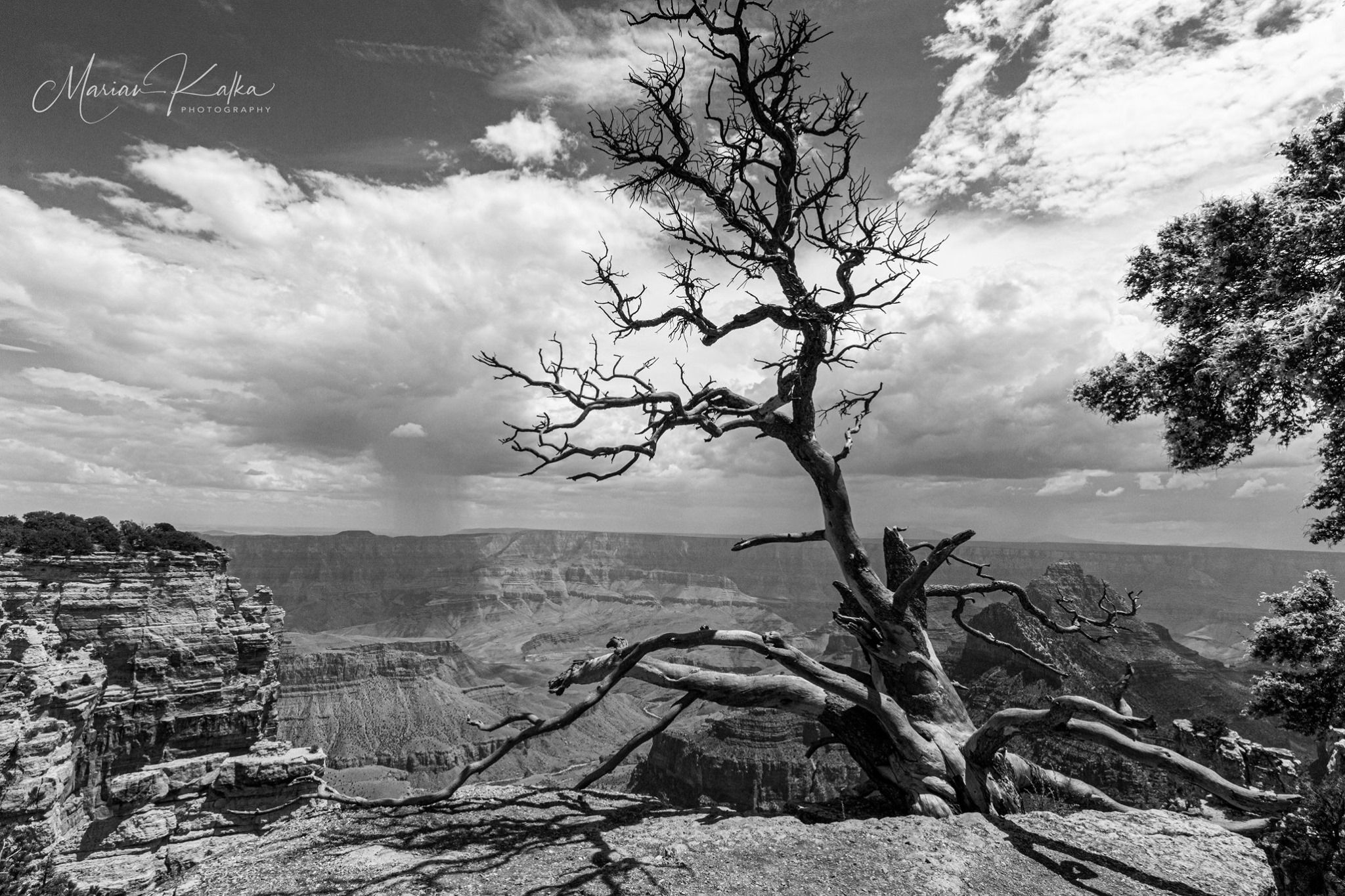
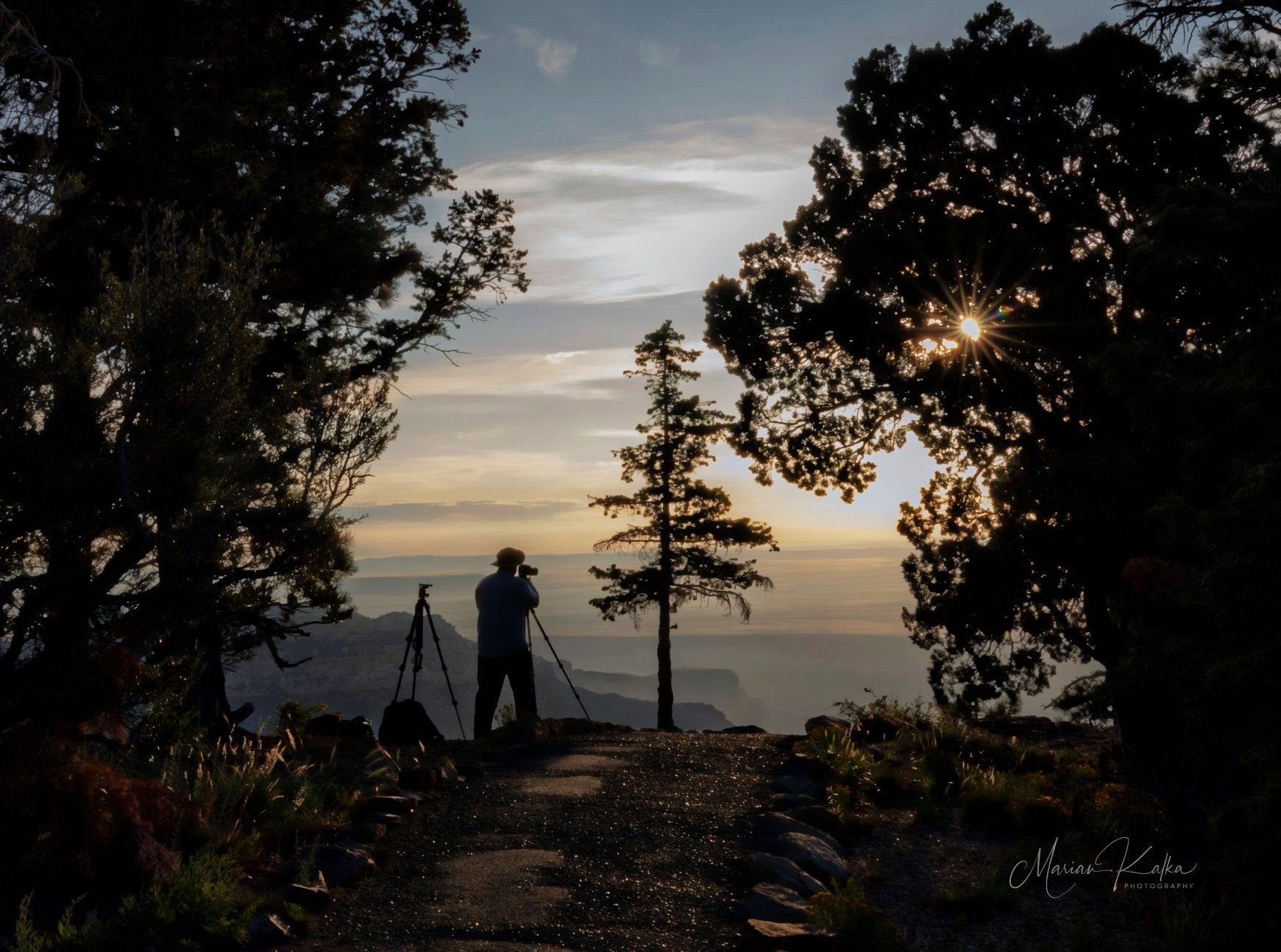
After the storm broke up a bit we moved on towards the North Rim Lodge and our rustic cabins. A really delightful dinner at the Lodge preceded an evening shoot from along the Bright Angel Point Trail, which is located along the rim just behind the Lodge. Not much in the way of storms on this night, but the Grand Canyon has a way of providing a wonderful show no matter the weather, and we soaked it all up from within a short walk of our comfy beds.
The following morning we rose to another shoot along the Bright Angel Point Trail. Anyone who has spent any time at Grand Canyon can tell you that the Canyon looks different all the time. Just sit with it. Even from the same vantage point as the evening prior, the Canyon looked different with the light from the east passing across the towers and buttes of the gigantic gorge. The silence here is deafening. The sheer magnitude of it all, overwhelming.
Grand Canyon became a National Park in 1919, after being set aside prior as a National Monument and before that as a Forest Reserve. Its human history dates back roughly 12,000 years as people have lived inside, as well as near its rims and neighboring landscape, thriving even in the dry, hot desert climate. Europeans would first arrive here in the 1500s and quickly deem it a good for nothing wasteland. A few hundred years would pass before prospectors would arrive and attempt to mine and exploit it for what it was worth to them (at that time). Mining was quickly given up on, even though some mines were relatively successful, to make way for tourism which has flourished ever since. Today the Park draws roughly 6 million visitors a year making it the second most-visited National Park.
Tourism at the Grand Canyon’s North Rim did not fully get going in earnest until roughly 1928. The original North Rim Lodge was completed at that time, and roads were finally in place so that folks could get to this beautiful spot. Having a lodge and a road were needed to open this location up to tourism. Shortly after, the original lodge burned to the ground yet the one we have now was built in the mid-1930s to replace it. The North Rim sees only a tiny fraction of those 6 million annual visitors, as it is quite far from any large population center and/or commercial airport. Because of its location, the feel’ of the North Rim is different than the South Rim, where most visitation takes place. The north side is quieter. There are fewer cars, fewer busses, less buzz. Just quiet, slower, more peaceful. It’s the reason we chose to have this tour go to the north side rather than the south, and our group really enjoyed that during our time there. Especially after the busier Monument Valley, Antelope Canyon and Horseshoe Bend. A nice way to finish our last couple of days together.
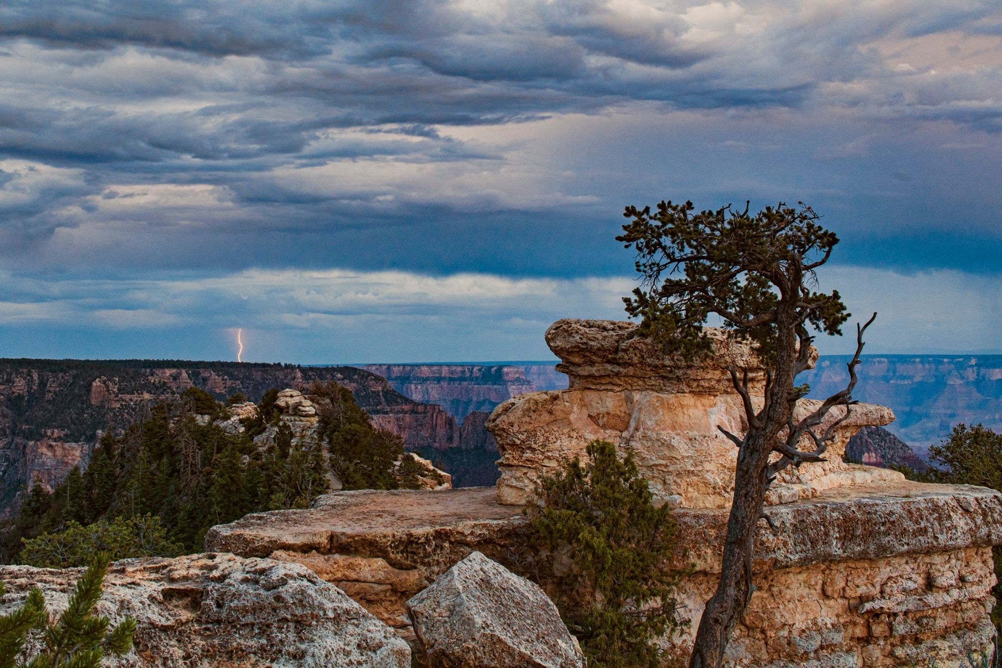
We took to afternoon to chase a predicted storm that was supposed to pop up over Marble Canyon, which is in perfect view from the north side’s highest viewing area, Point Imperial. We took the afternoon to run up to Point Imperial, and the storm was there! Still quite a ways off, to a point that we could not hear thunder. Maybe a bit too far away, but we watched the light change over the Canyon from this amazing spot, and shot the storm until it dissipated. We also scouted the area because this would be our final sunrise spot the following morning, so we took a good look and sized up the location for our next day’s composition.
Following another fantastic dinner at the lodge, we decided to shoot from the Bright Angel Point Trail again because storms were brewing along the southern rim of the canyon, perfectly in view from that location. We were rewarded for our choice by plenty of storms along the rim.
Bill Harvey
A few in the group managed to get some lightning shots, but again the storms were just not the strength they typically are and the lightning was pretty small due to the distance the storms were from us. Successful night, though, as everyone was enjoying themselves to the fullest. Some in the group decided to dub us “Flash Krueger (me) and the Lightning Bugs” and got a pretty big kick out of that idea. Their laughter on this evening may have been heard by folks sitting 10 miles away on the other side of the great chasm (kidding, of course. Or, am I?) A toast on the lodge patio was in order, as we had only one remaining shoot in the morning that would conclude this amazing adventure! Time sure had slipped away quickly.
Point Imperial is my definitely my favorite spot (that you can drive to on pavement) on the North Rim. It sits at 8,803 feet in elevation, yet the real beauty comes more from what it overlooks. From this point, one can see the Painted Desert and the eastern end of the Grand Canyon, including the confluence of the Little Colorado River and the Colorado River, which is a very sacred location to many of the local tribes. Marble Canyon, Navajo Mountain, Mt. Hayden are all in view here. Just a magnificent spot!
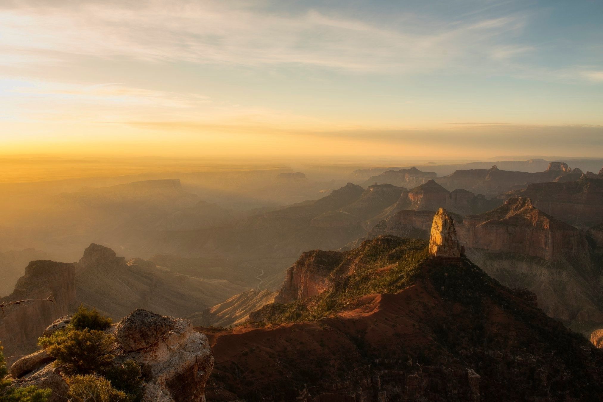
The morning light was nice for our final sunrise of the trip. No clouds or storms to utilize, but the moment was special and the images made on this morning by folks in this talented and wonderful group were simply fantastic.
Bill Harvey
After breakfast back at the lodge, we departed for our journey home.
And so it goes that the inaugural Backcountry Journeys “Southwest Monsoon: Grand Canyon Country” tour was a great success! Even without any powerful Monsoon storms.
The locations visited and images created are among some of the best that we’ve seen. More importantly, however, the personal connections of a group of fellow travelers may have stood out the most. We often think of our journeys as quests to get photographers to a selection of spots at just the right time to photograph the area in its best light. While these tours are just that, they are also chances for like-minded folks to travel together. To teach each other, and learn from one another. A chance to find new and potentially lasting friendships through shared experiences and achievement. This is the truly special aspect of what we are doing on these tours and this is what stood out the most to me as I reminisce on “Flash Krueger and the Lightning Bug’s” adventure.
“Donn” by Marian Kalka
I will never forget my friends Bill and Laurie, Gordon, Roy, Woods, Marian, and Donn. I know that I’ll one day use my images from this trip to remind me of that uncontrollable laughter of those good folks who were kind enough to bring me along with them for a wild ride across the desert during that dry summer of ’19.
This one was truly ‘one for the books!’

We offer world-class travel photography
experiences around the world.
Each tour is bundled with lodging, meals, and transportation between workshops included, allowing you to focus on photography instead of the stress of traveling.
experiences around the world.
Each tour is bundled with lodging, meals, and transportation between workshops included, allowing you to focus on photography instead of the stress of traveling.
Get Our Trip Catalog
Receive a trip catalog that highlights all of our upcoming photo tours and workshops.Schedule a Trip Consultation
Meet with a photo experience coordinator, and experience a personal touch to your booking experience.Landscape Guide
Receive a FREE Landscape Cheat Sheet Written By a Pro Photographer.Webinars
Our regularly hosted webinars provide photography instruction from our own guides on a wide range of topics.Education Portal
Explore our library of articles that cover everything from common questions, to in-depth guides on how to achieve that perfect shot.
Backcountry Journeys
Connecting Passionate People To
Exceptional Experiences.
Exceptional Experiences.
Business Hours:
Mon-Fri, 8AM-4PM MT
928-478-1521
adventure@backcountryjourneys.com
Mon-Fri, 8AM-4PM MT
928-478-1521
adventure@backcountryjourneys.com
arrow_drop_down_circle
Divider Text
All Images & Content Are Property Of Backcountry Journeys Photography Tours, Workshops & Safaris LLC - Copyright 2026
About Us
Receive a Digital Trip Catalog
Find an upcoming photography tour with our interactive catalog.